

A major cold front is here bringing with it some much, much needed rainfall.
Clouds are likely most of the day Friday, with just a few peeks of sun possible during afternoon. Winds will pick up ahead of the approaching strong cold front around 15-20 m.p.h. for a few hours in the afternoon as well. Highs will soar into the mid-70s.
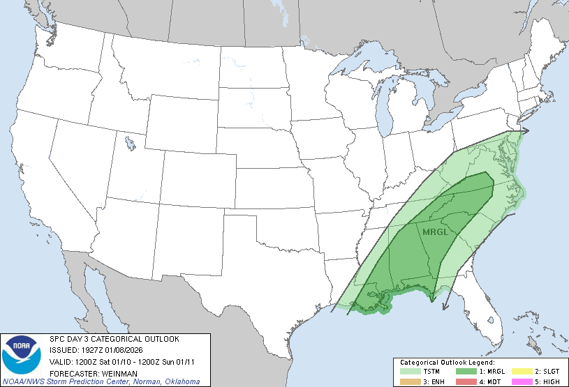
Showers will become likely overnight and some embedded thunderstorms are also possible. The Storm Prediction Center has placed all of West-Central Georgia under a marginal risk for severe storms from very late Friday night through the afternoon on Saturday.
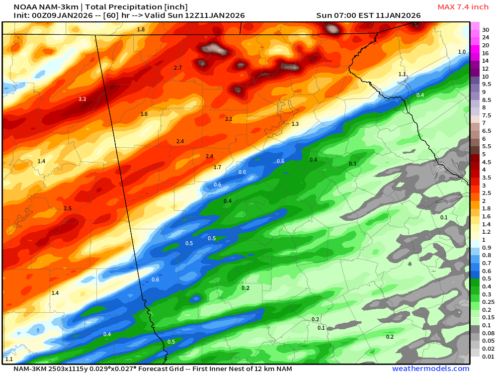
The primary threat from any of these storms will be damaging winds. In addition to the severe storm risk, there is also a chance for some heavy rainfall. The latest modeling can be seen below and shows several rounds of heavy rain moving through the state from late Friday night through late Saturday evening. Rainfall totals will drop off the further south you get, but most of our region should still see some heavy rain at times. The most likely times for the steadiest heavy rains will come on Friday night through mid-morning Saturday with more scattered precipitation after that.

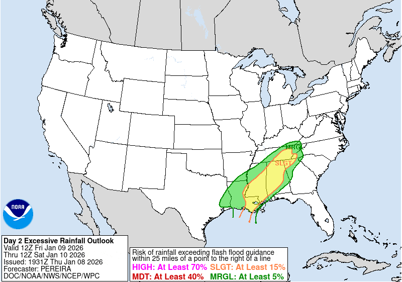
There is a marginal risk for some flash flooding across the far north/west part of the region. The Weather Prediction Center draws the line roughly from Columbus up to Atlanta.
Total rainfall from the storm will vary quite a bit, but I do believe most of us will see around 1/2-1″ of rain from this system with isolated higher amounts possible.
Behind the cold front we will cool off significantly. Highs will drop into the 50s for Sunday through next Tuesday. Winds will be very breezy behind the front on Sunday at 25-30 m.p.h. We’ll also fall back below freezing on Monday and Tuesday mornings so be sure to double check any exposed outdoor pipes!

