

A major cold front will bring some much needed heavy rain as well as some storms to North Georgia this weekend.
Models are coming into better agreement on the timing and strength of an approaching cold front. Clouds will be streaming north on Friday ahead of the system, and strong flow from the south/southeast could kick off some isolated showers. These are most likely over the mountains where the bit of extra lift from the elevation gain will help wring out moisture.
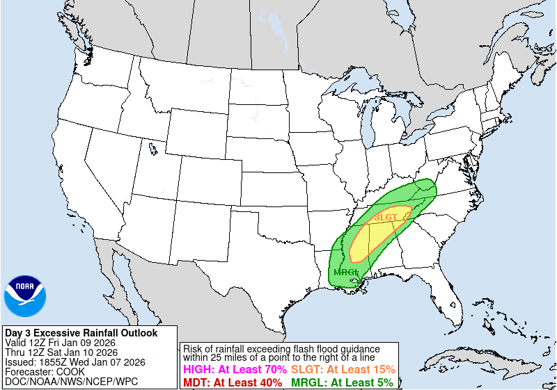
The rain will become heavier and more widespread on Friday night and there is growing potential for a heavy rain and isolated flooding event on Saturday. The Weather Prediction Center now has much of North Georgia under a marginal risk for flash flooding on Friday night, with a slight risk for far Northwest Georgia. This risk area is likely to expand east through the day on Saturday.
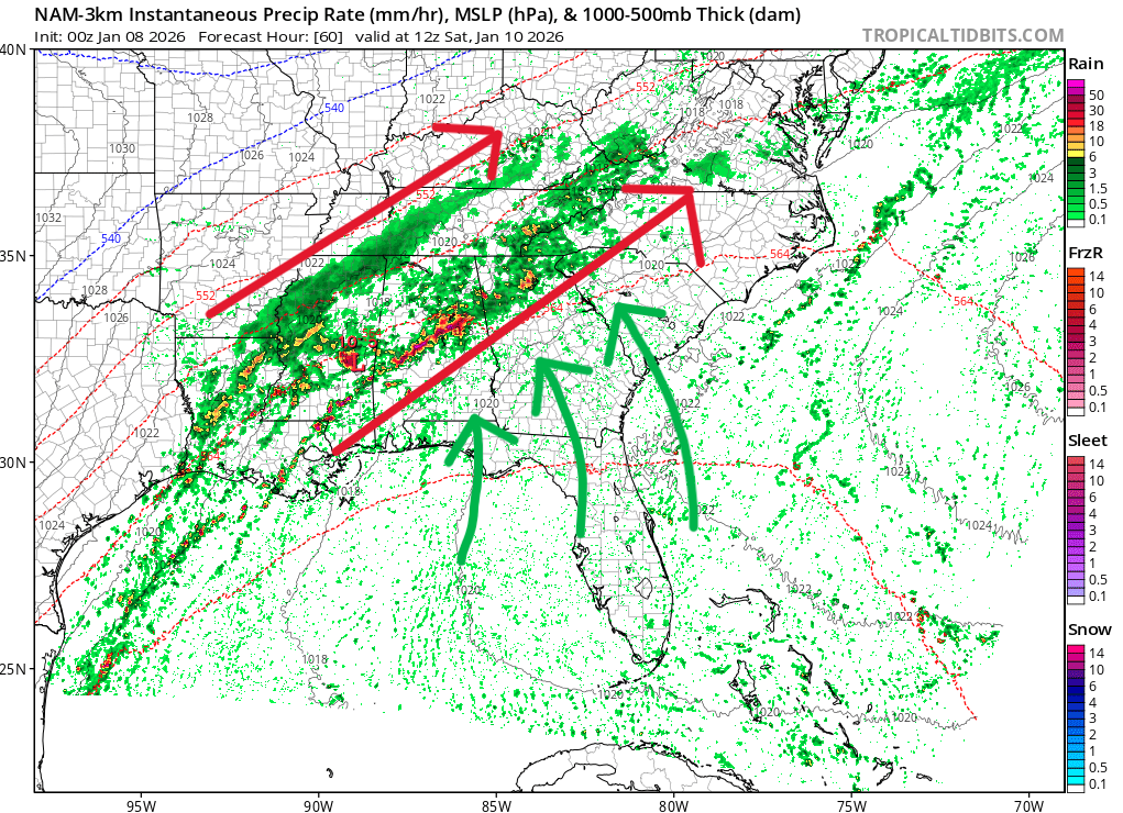
The reason for this risk is a “firehose” of moisture expected to move slowly east ahead of the front. The animation below shows this very well through early Saturday morning. Multiple rounds of heavy rain are expected to hit the same areas over and over as the front slowly marches east. By early Saturday morning, a secondary low pressure system may develop back over MS/AL which could work to enhance the rainfall through the day Saturday.

This front will be aided by well-above-average water temperatures in both the Gulf and Southeast Atlantic. Water temperatures are in the low/mid-70s out over open water, meaning lots of moisture will be available to transport north. A freeze frame at 7 a.m. Saturday reveals the setup for later in the day across North Georgia.
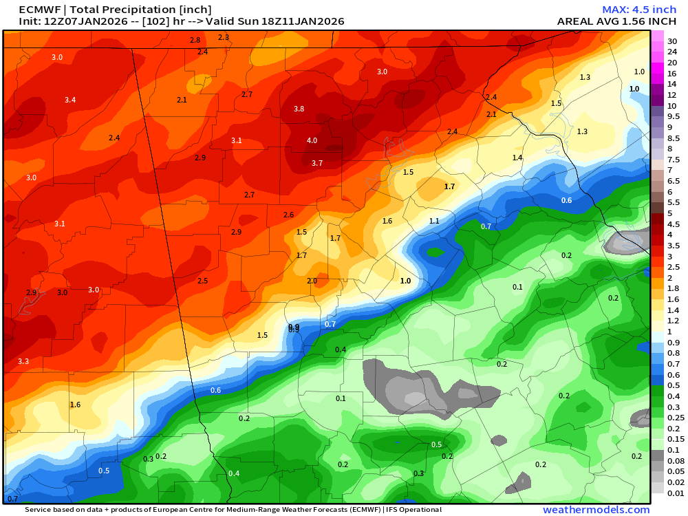
The heaviest rainfall totals are expected to fall roughly along and north of the I-20 to I-85 corridor in north/west Georgia. The further north and west you live, the more rain you will likely receive. The Euro model has bumped rain totals for the system up to 2-4″ across the area, with isolated higher amounts possible.
While it has been very dry across the region lately, this can counterintuitively raise the flash flooding risk. Dry ground doesn’t do nearly as good a job at soaking up water due to compaction. This means heavy rains can quickly run-off enough to cause problems. Couple that with this being the dead of winter and trees not soaking in as much either, and flash flooding will certainly be possible.
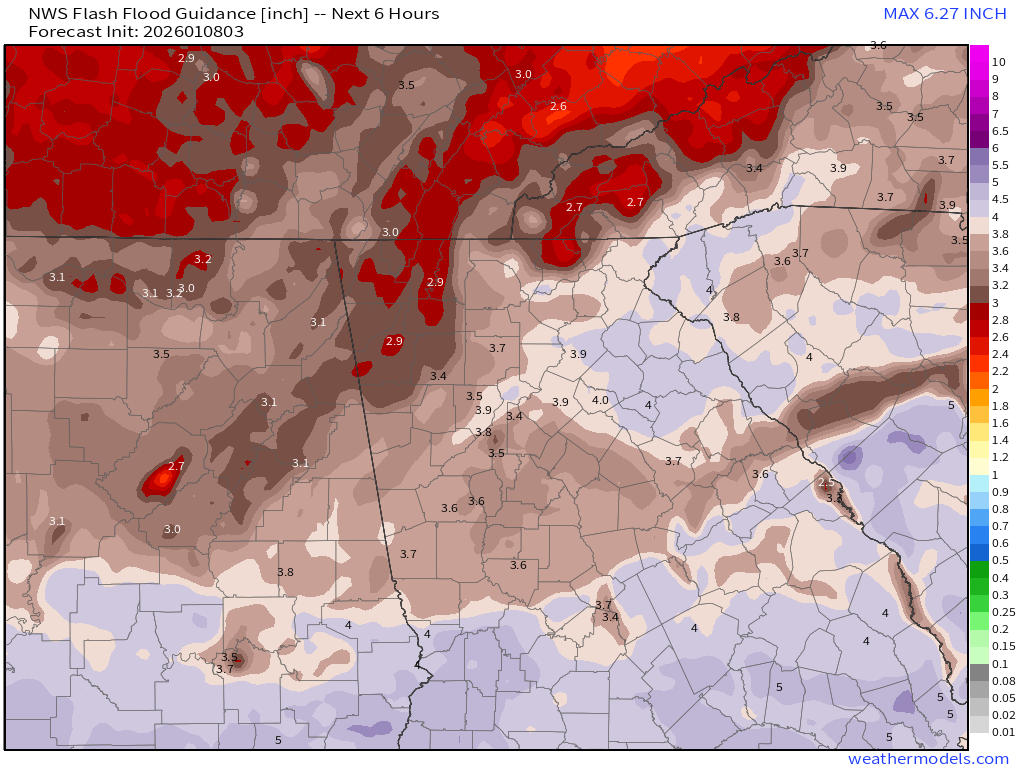
We’ll be keeping a close eye on Flash Flood Guidance into the weekend, which is the amount of rain in a period needed to result in flash flooding. The latest analysis is around 3.5-4″ in a 6-hour period for most of North Georgia but this number will change.
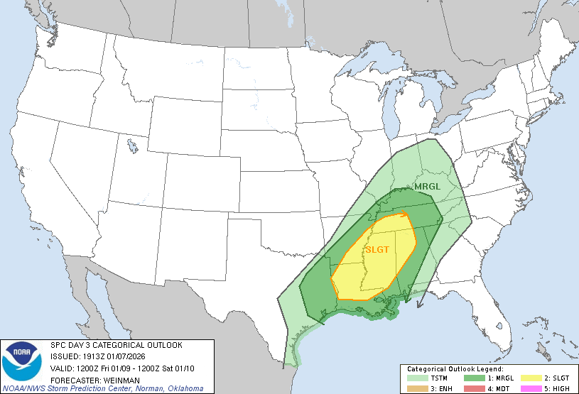
In addition, a low end risk of damaging winds will accompany this front, mainly across Northwest Georgia. A marginal risk of severe storms is outlined by the Storm Prediction Center for Saturday, but only clips the far northwest corner of the state.
Stay tuned for the latest on this storm that will take us back to winter temperatures by Sunday.


