

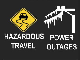
Rain, sleet and freezing rain are expected to begin in our area early this afternoon and worsen as the day goes by and into the night. It’s not expected to end until about daybreak Monday.
“We are expecting freezing rain to begin impacting far NW GA in the early afternoon spreading eastward and beginning to affect NE GA and then Atlanta metro area Saturday evening with deteriorated road conditions expected through Monday morning,” the National Weather Service (NWS) says in an advisory issued early Saturday morning.
In fine-tuning the timeline for the onset of precipitation, forecasters say it will begin in Gainesville and other parts of northeast Georgia, which are still under an Ice Storm Warning, about 1:00 this afternoon and cause “minor” problems until about 7:00 this evening when “moderate” problems begin. Conditions will continue to deteriorate and by 1:00 Sunday morning, sleet and freezing rain will begin to create “major” problems with icing on roads, trees, powerlines, etc. And by 7:00 Sunday morning, things will reach their peak with “extreme” conditions which will stay with us until early Monday morning when the precipitation begins to end. And winds gusting to as high was 25 mph are expected as well.
But that’s not likely to end our problems. The ice is expected to continue to cause hazardous conditions throughout the day Monday. Daytime highs in the 30s are forecast for most of next week with lows in the teens and 20s, bottoming out at 11 Monday night.
The 7-day NWS forecast for Gainesville and vicinity:
Today
A 30 percent chance of showers, mainly after 5pm. Cloudy, with a high near 39. East wind 10 to 15 mph, with gusts as high as 25 mph.
Tonight
A chance of rain showers and sleet before 8pm, then freezing rain and sleet. Low around 25. East wind around 15 mph, with gusts as high as 25 mph. Chance of precipitation is 100%. New ice accumulation of 0.1 to 0.3 of an inch possible. New sleet accumulation of less than one inch possible.
Sunday
Freezing rain, possibly mixed with sleet, becoming all freezing rain after 10am. High near 33. East wind 10 to 15 mph, with gusts as high as 20 mph. Chance of precipitation is 100%. New ice accumulation of 0.3 to 0.5 of an inch possible. New sleet accumulation of less than a half inch possible.
Sunday Night
Showers likely, mainly before midnight. Mostly cloudy, with a low around 24. East wind 5 to 15 mph becoming west in the evening. Winds could gust as high as 25 mph. Chance of precipitation is 60%.
Monday
Sunny, with a high near 34. Northwest wind around 15 mph, with gusts as high as 30 mph.
Monday Night
Mostly clear, with a low around 11.
Tuesday
Sunny, with a high near 37.
Tuesday Night
Mostly clear, with a low around 21.
Wednesday
Mostly sunny, with a high near 40.
Wednesday Night
Mostly clear, with a low around 22.
Thursday
Sunny, with a high near 35.
Thursday Night
Mostly clear, with a low around 16.
Friday
Mostly sunny, with a high near 37.
To contiune reading click here.
It was originally published on this site.


