

A rare nearly state-wide chance for snow is expected across all of Georgia on Saturday night.
The latest short-term weather models are showing a significant northwest shift to the extent of the overnight precipitation across the state.
A Winter Weather Advisory is in effect for Baldwin, Bibb, Bleckley, Chattahoochee, Crawford, Crisp, Dodge, Dooly, Emanuel, Glascock, Hancock, Houston, Jasper, Jefferson, Johnson, Jones, Laurens, Macon, Marion, Monroe, Montgomery, Muscogee, Peach, Pulaski, Putnam, Schley, Stewart, Sumter, Talbot, Taylor, Telfair, Toombs, Treutlen, Twiggs, Upson, Warren, Washington, Webster, Wheeler, Wilcox, and Wilkinson Counties across Central and South Georgia. In these areas, which includes Columbus, Macon, Dublin, Americus and Eatonton, up to 1/2″ of snowfall is expected with isolated amounts up to 1″. While the snow could fall at a decent rate at times, the ground temperatures are far too warm for any significant impacts to be seen. Still, snow in these areas is rare and will be a nice treat for the region.
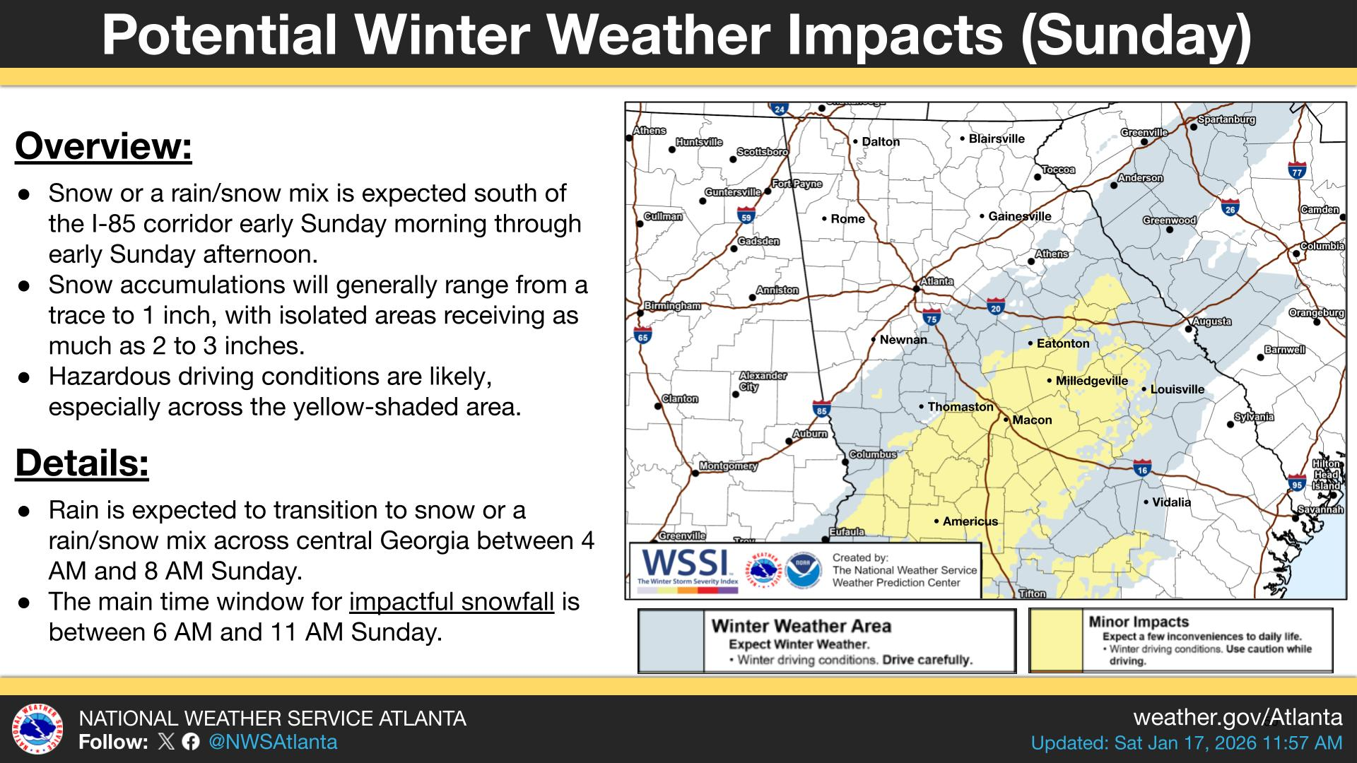
Further north there has been an increase in the confidence of at least some precipitation falling across the region. Both the short range HRRR model and the NAM model show some falling across most of Northeast Georgia Saturday evening from around 7PM to midnight.
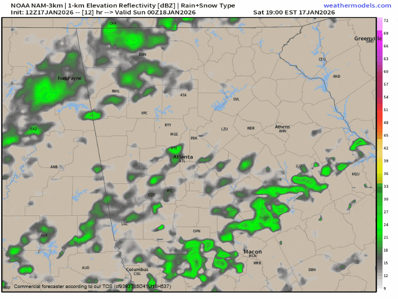
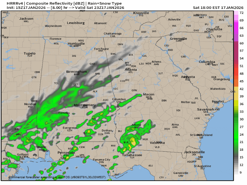
It is worth noting that while both these models do show a second wave forming (on the HRRR-right, which only runs 18 hours out) and moving through (the NAM-left, which runs a full 60 hours out) but dry air will be a major problem.
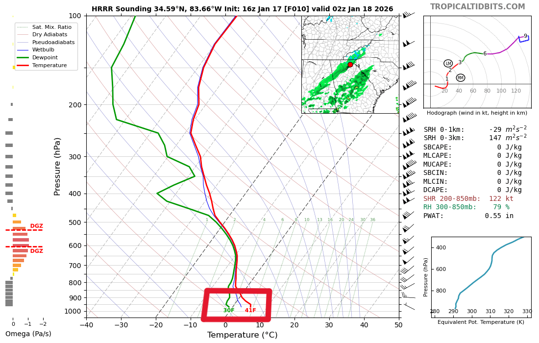
The best chance for anything to reach the ground will come during the evening/early overnight hours of Saturday for those north of I-20. Even still, the forecast sounding- or what the atmosphere looks like- below shows dry air which could preclude even the early precip from reaching the ground. This can be seen as the big gap between the green line (dewpoint) and the red line (temperature) below. In the event some of the precipitation does reach the ground, all indications are that we will remain above freezing everywhere except the higher elevations of the mountains.
Because of the temperature/dry air problems, any accumulations are expected to be very light and relegated to the mountains. You can see the image below shows the potential for a dusting across the entire region, but I am not particularly confident in this.
Further south areas from Columbus to the northeast around Macon seem to be in the best shape currently with the best potential for 1-2″ coming in that area. Keep in mind, ground temperatures will melt some of this off with the highest accumulation on elevated and grassy surfaces.
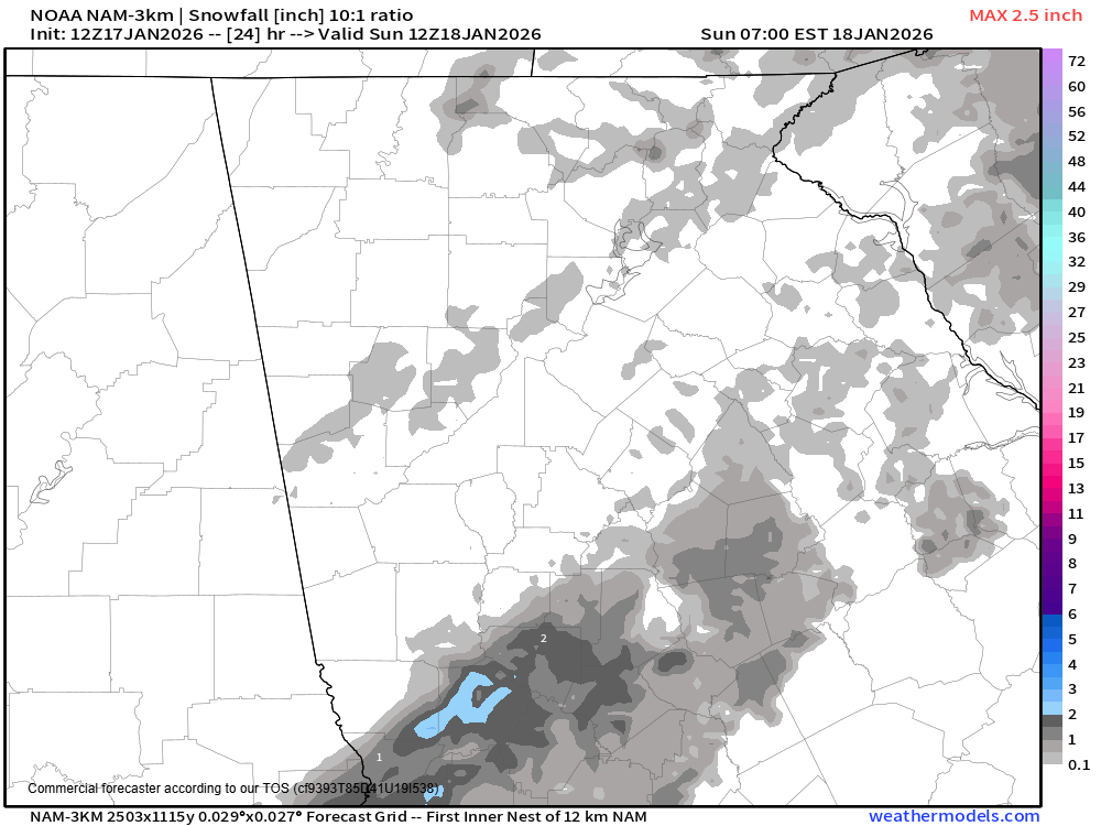
Snowfall potential on the NAM model, just a dusting at bestThis is a developing situation and we are quickly moving into “nowcast” time for this event, but further shifts northwest are not impossible over the coming hours which could change things just a bit.
Stay tuned for the latest!


