

Social media has been abuzz this past week with emoji-filled forecasts from long-range weather models painting a picture of heavy snow across North and even parts of Central/South Georgia. Now that we are getting closer to the timeframe with the best chance, here’s a realistic look at what to expect.
Wednesday Night Flurries
The first chance for snow will come behind a very strong cold front moving into the region on Wednesday night. A line of showers will run right along the leading edge of the colder air, and it is highly likely the higher elevations will see a changeover to snow around 7-9 p.m.
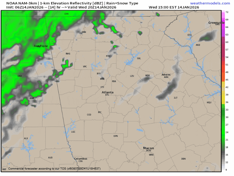
Accumulations are expected to be limited to areas above 2500ft elevation. Spots with the best chance for a dusting to 1/2″ include Sky Valley, Brasstown Bald, Suches, and the Cohutta Wildlife Management Area in western Fannin County. The high passes of the highways on Neels, Unicoi and Hogpen Gaps as well as Hwy 180 could become slick overnight so use extreme caution when travelling.
With that said, flurries are likely across most, if not all, the region from 9 p.m. through the early morning hours of Thursday as the incoming cold air squeezes out all available moisture. The bigger story with this system will be the cold air and winds the front brings.
READ MORE: Major Front to bring single digit wind chills to North Georgia
Saturday/Sunday weather
The next timeframe that would bring a chance for some snow is Saturday night into Sunday. Another strong front will drop south on Saturday. Rain is likely ahead of the front, and a few wrap-around snowflakes are also possible with this system, but not as likely as Wednesday night.
As a large upper level trough digs in, which you can see below, a low may develop somewhere in the Gulf and push to the northeast. Both the major weather models, the GFS and the Euro, show this happening. However, they do not agree on placement, and this is one of those situations where just 50-75 miles can have a big difference on our forecast.
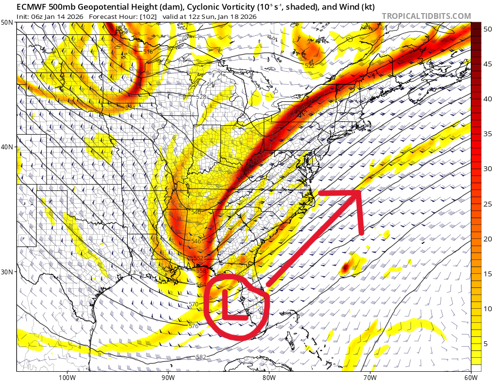
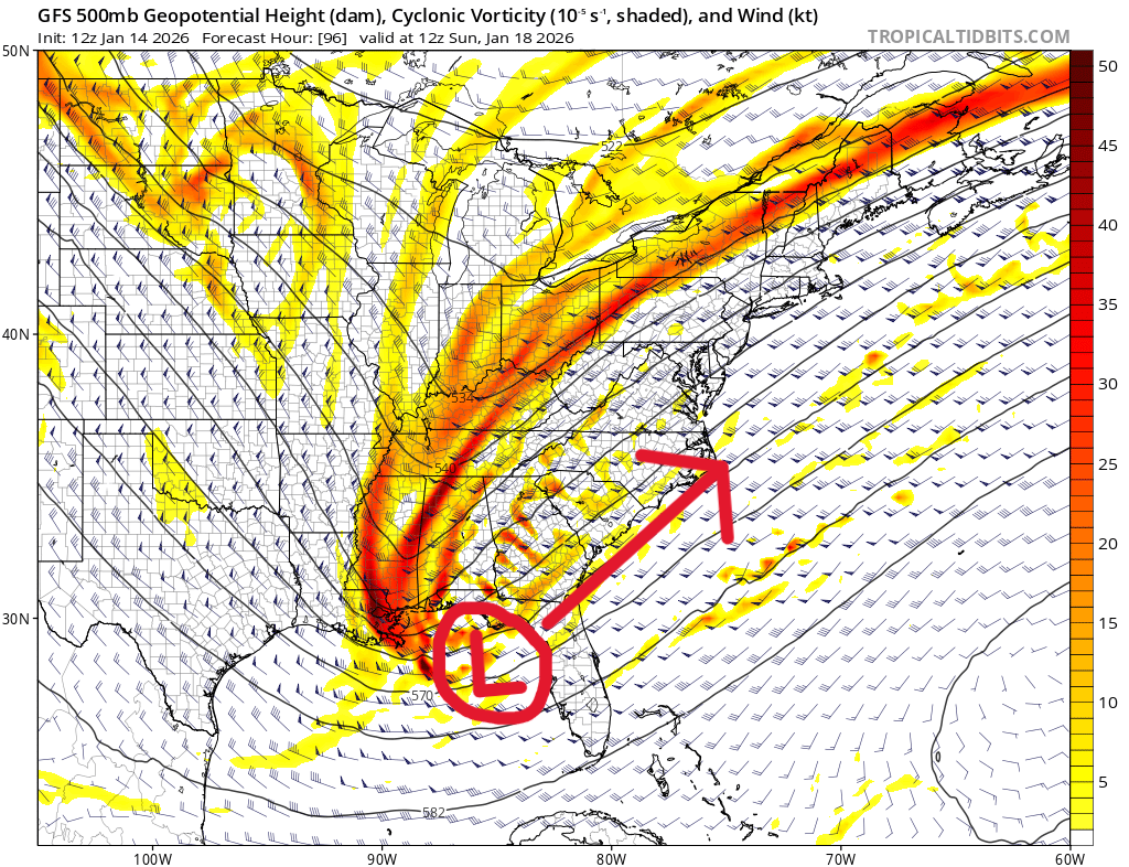
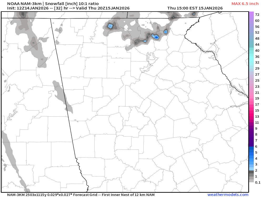
A track more like is shown by the GFS could potentially throw enough moisture back west to bring some light snow to our region early on Sunday morning. Even in a best case scenario, any accumulations would be light, but it could be more than zero. That solution can be seen below. Alternatively a more Euro-like track would bring a chance of snow to Myrtle Beach, but not us.
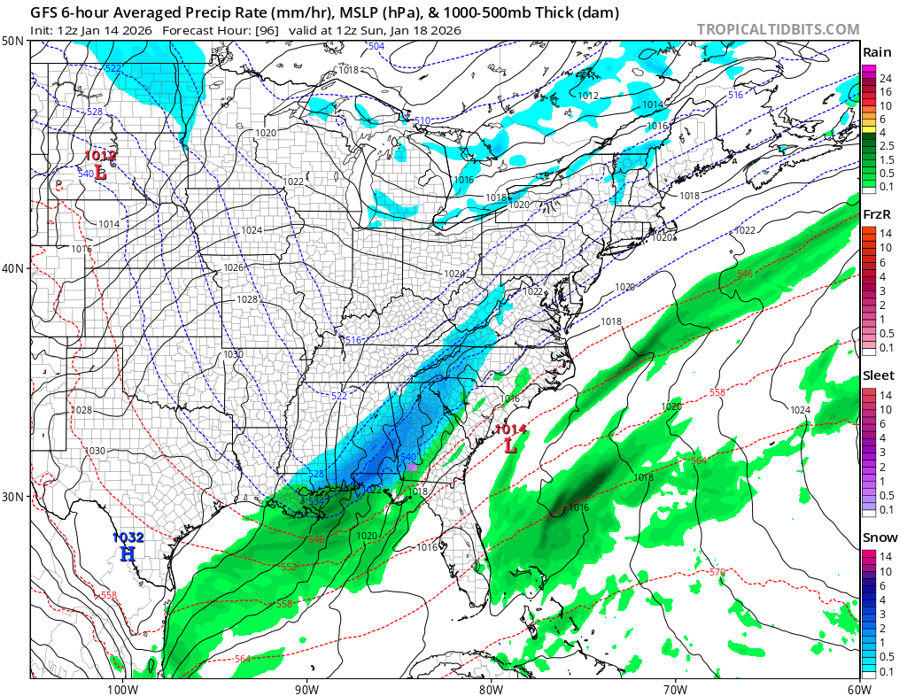
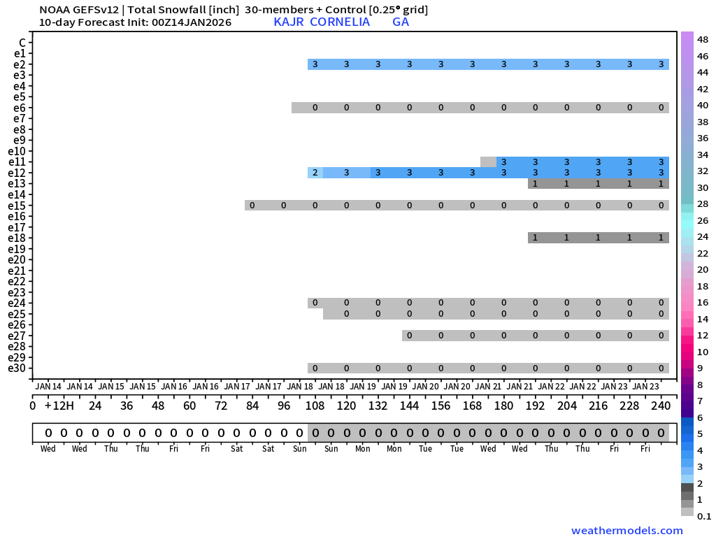
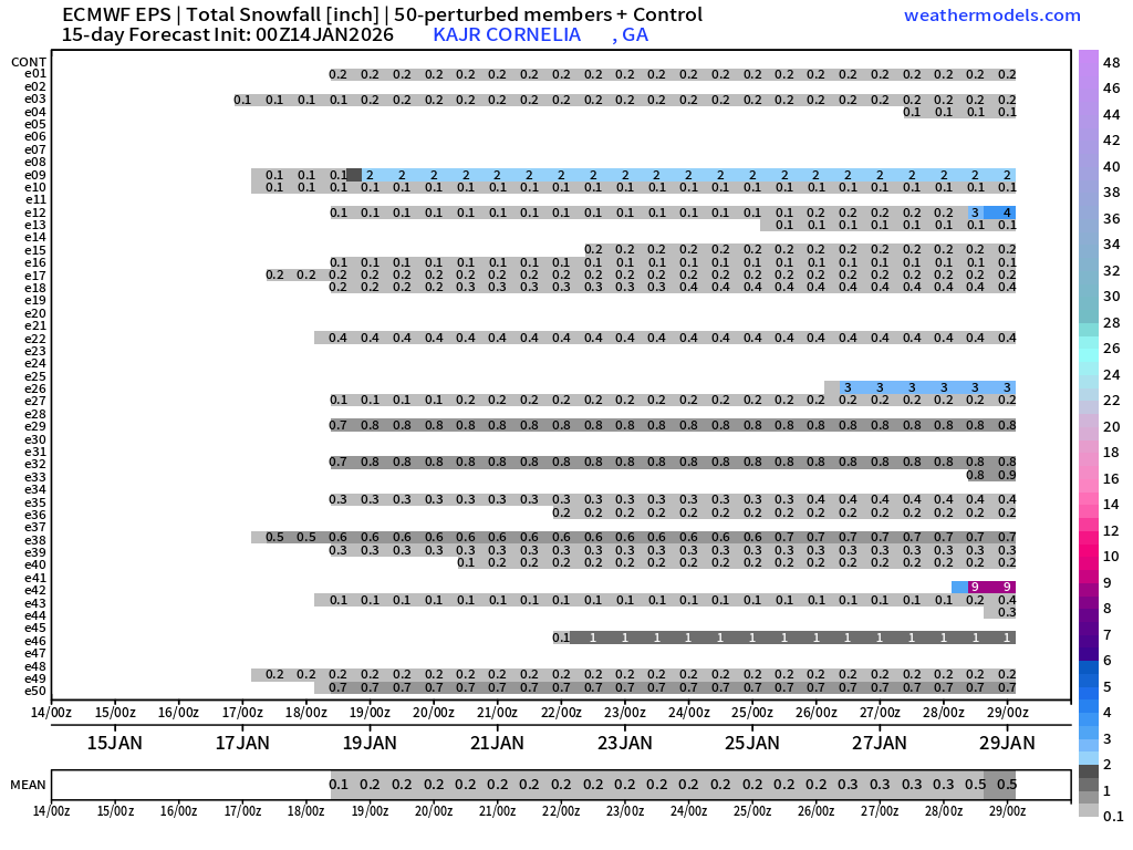
It is worth noting that even with the map you see above, dry air at the surface could cause some issues for any of that actually reaching the ground. Even more unfortunately for us, the Euro has been beating the GFS up one side and down the other recently in terms of accuracy. That doesn’t necessarily mean much every time, but it isn’t a good sign. One thing to look at for a better picture are the Ensembles, slightly differing versions of each model. You can see both the Euro and GFS versions below, and neither show any kind of consistency with more than a dusting at any given time.
Maybe, but probably not
At the end of the day, Sunday is still 4-5 days away and things can/will change. The pattern is certainly conductive for snow somewhere across the southeast and minor changes could easily result in a better chance. At the moment, our chances of seeing anything more than a dusting are around 10%. So maybe, but probably not.
As you are perusing social media this time of year remember not to confuse detail with accuracy or “professional” with reliability. Far too many people fall victim to the clickbait weather pictures and “forecasts” this time of year, and wind up very disappointed. Snow in the southeast is very hard to get, and while I am hopeful we see a change, this time around doesn’t look much in our favor right now.


