

Editor’s note: In July 2025, Now Habersham weathercaster Tyler Penland headed west to hike and camp in Yellowstone National Park. His latest “Go west, young man” series features the stunning images he captured and the stories he brought back.
Our time in Yellowstone was behind us, but our trip was far from over.
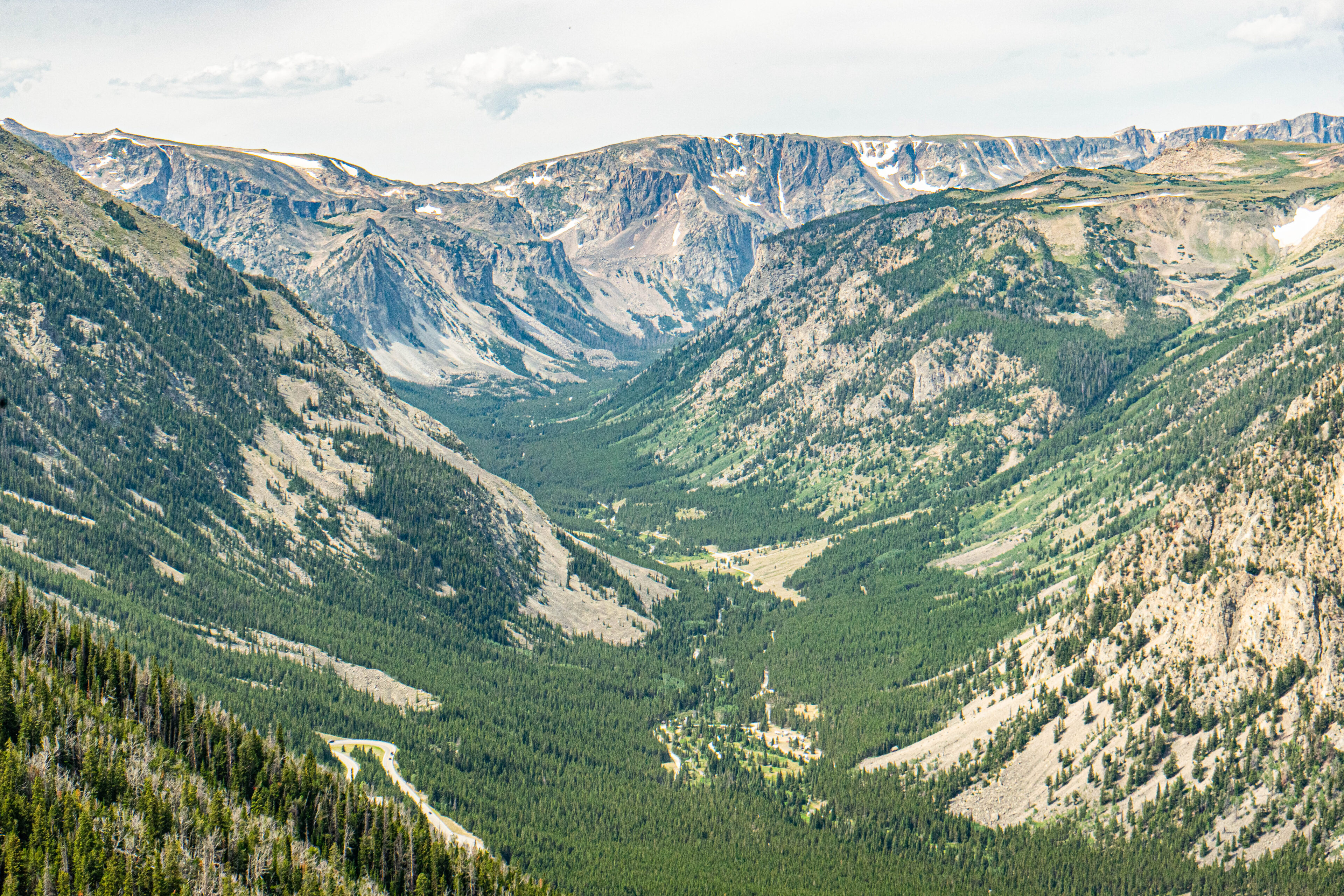
When you drive out of the northeast corner of Yellowstone National Park, you instantly enter the Absaroka-Beartooth Wilderness. US Route 12 runs into the tiny town of Cooke City, Montana just over the state line. This tiny town is the last chance to restock on any essential supplies before taking the 69 mile drive up one of the most beautiful drives in the country. US Route 12 is renamed the Beartooth Highway for this section as it bounces north and south along the Montana/Wyoming border. Cooke City sits around 7600ft above sea level, but you still have over half a vertical mile to go before reaching the top.
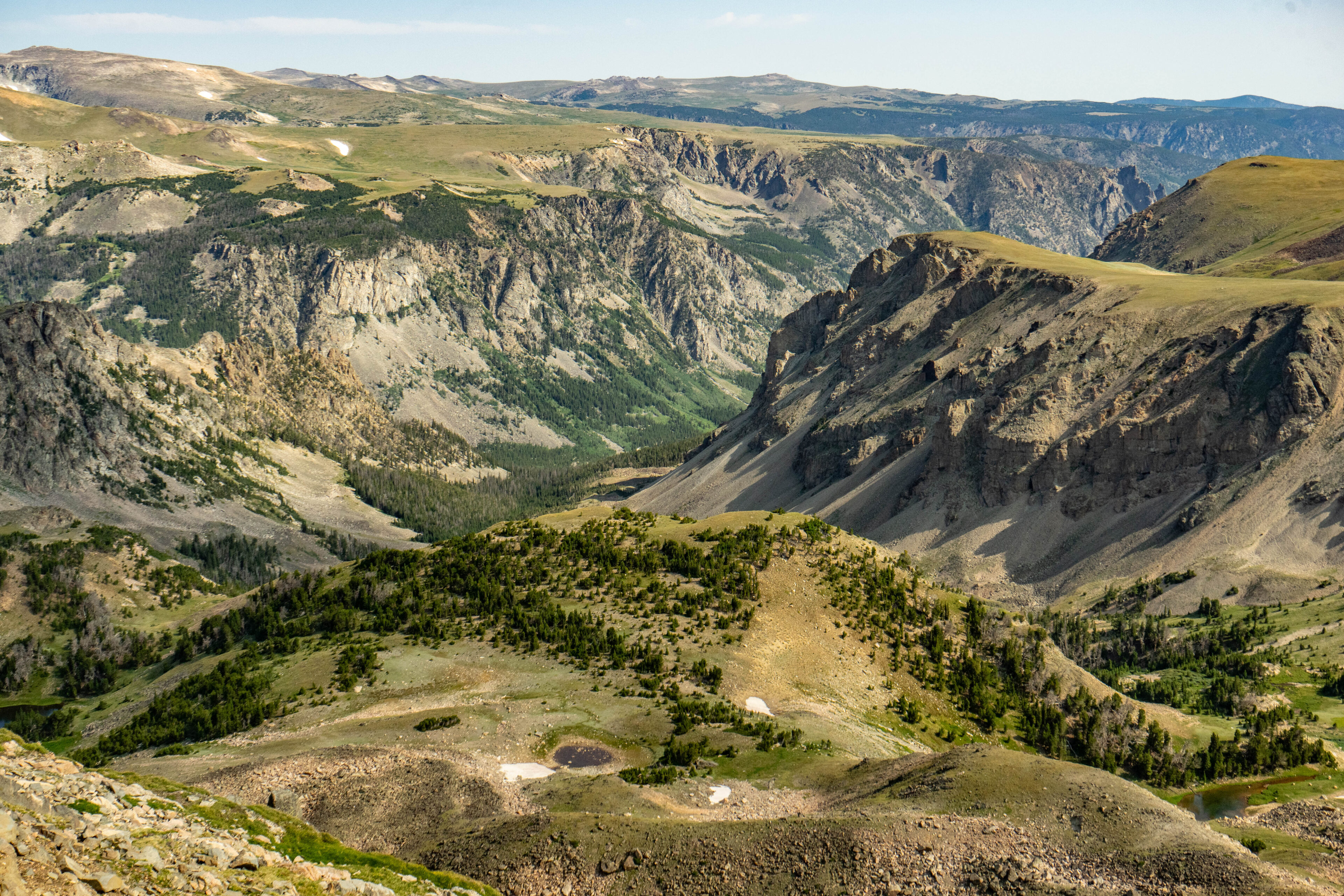
The road quickly climbs into the glacier-built landscape of this region. Tens of thousands of years ago glaciers ground the mountains here into a large plateau. What it left behind is some of the most easily accessible beautiful scenery in the country.
After a stop in Cooke City we made our way to the Island in the Sky campground. We were quite tired, and so we took the night off. The next day we started up the highway for an “easy” day before the next couple days of tough hiking. The drive to the top is very steep. This particular morning, haze was moving in which made photography very difficult, but it is hard to hide the beauty of this region. We made our way straight to the top.
The top of the highway reaches a lung-wheezing 10,947 feet above sea level. The small rises around the summit will take you just over 11,000ft if you are feeling antsy to turn the altimeter over. This was my first trip to this elevation since October of 2023 when I made a brief visit to Pikes Peak, Colorado. This was a great way to prepare for our 12,000ft summit attempt that would come on the next couple of days, but I would be lying if I said I wasn’t getting pretty winded just walking around. Up here, snow falls in the tens of feet deep through the winter. There was quite a bit left around the summit even by our visit in late July.
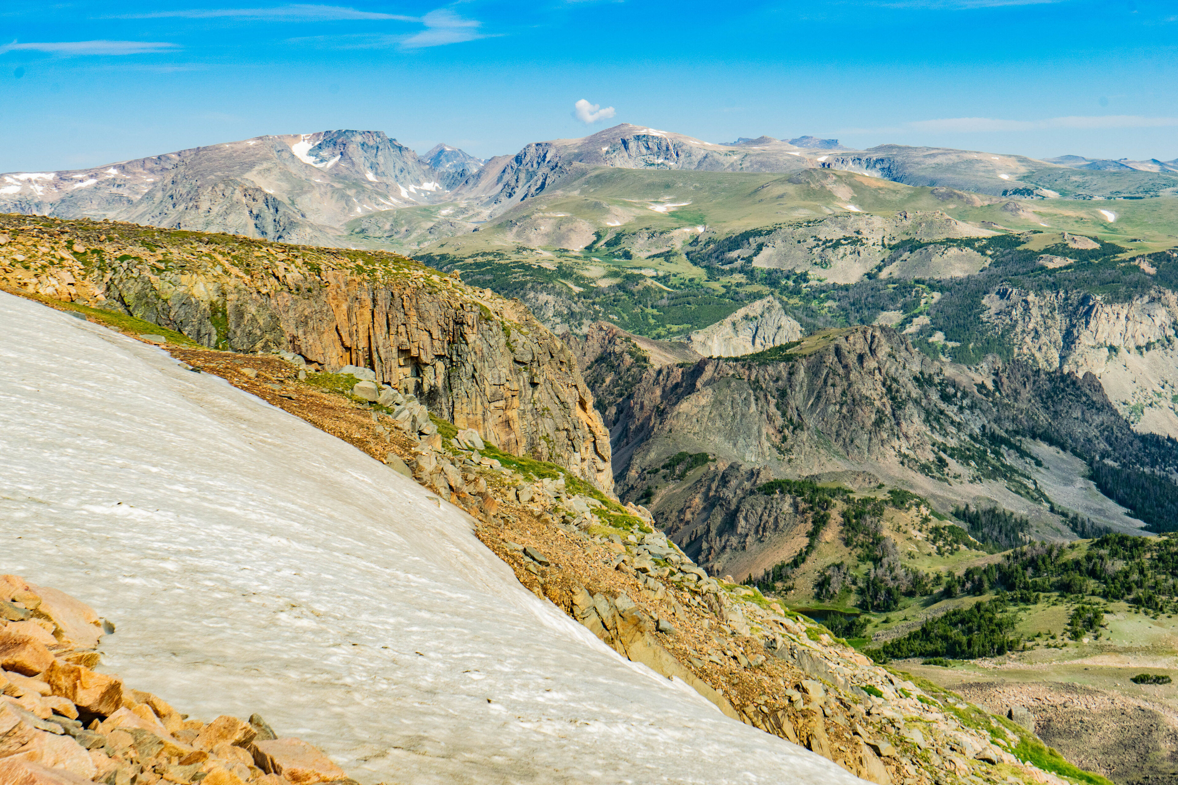
Considering snow was again falling here less than one month after my visit, there’s no way this snow melted all the way. Up here, the remnants of many, many glaciers remain where the snow/ice never melts. The juxtaposition of the snow and the high elevation wildflowers is quite something.
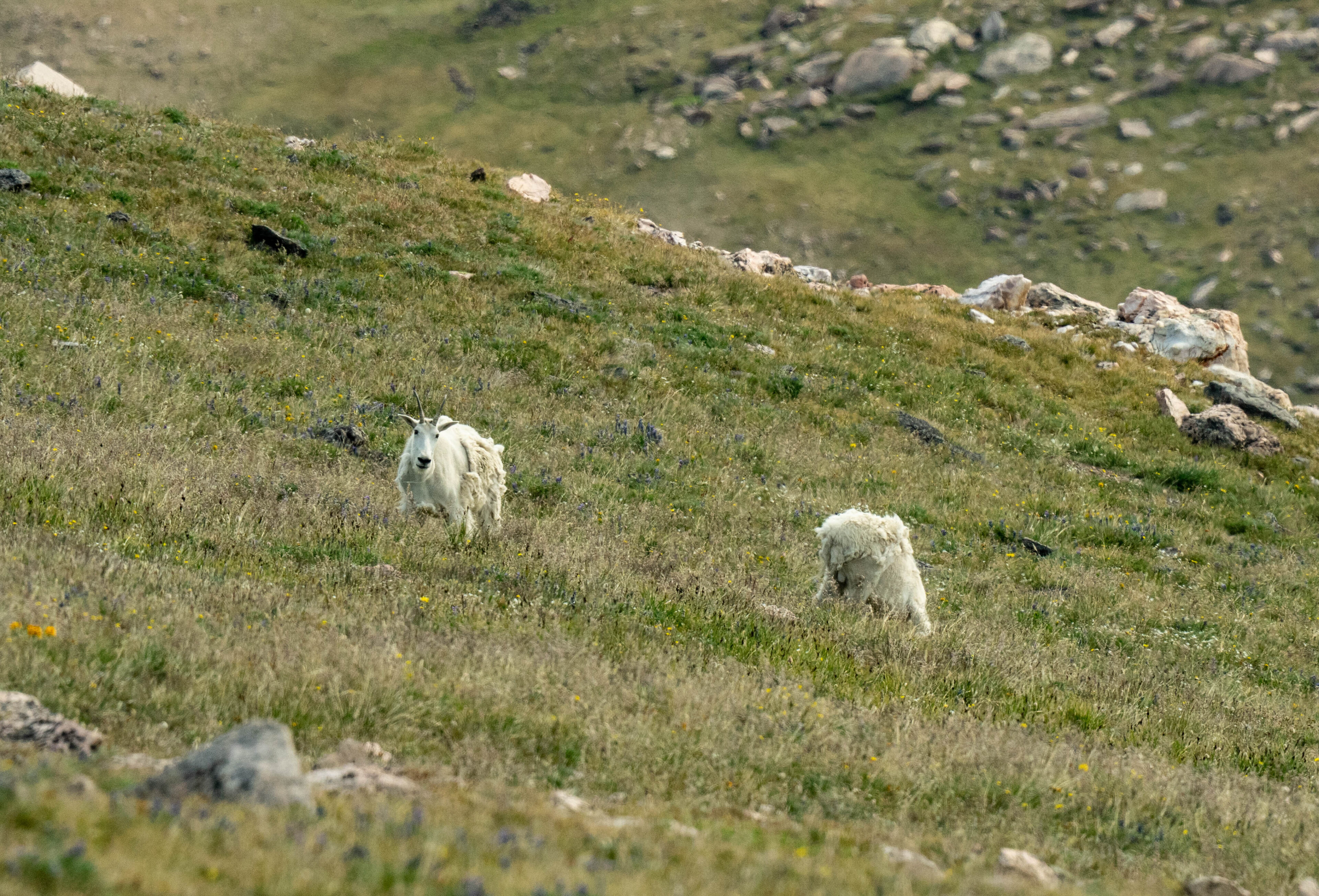
The harsh climate and rough mountains doesn’t allow for a ton of wildlife. However, countless mountain goats call these places home. Through the winter they migrate to lower elevations, but in the summer it is nearly impossible to take a drive along the road and not see some. They were actually doing a fairly good job of hiding from us this day, but nevertheless we managed to find some grazing. Note the hundreds of rocks, these were all left behind as the enormous glaciers melted, leaving behind the plateau.
The road on the Red Lodge, MT side is nothing short of an engineering miracle. Here, the switchbacks are incredibly close together as the road sidewinds up the steep cliffs. This means there are a lot of pull-offs at the u-turns to take in the views.
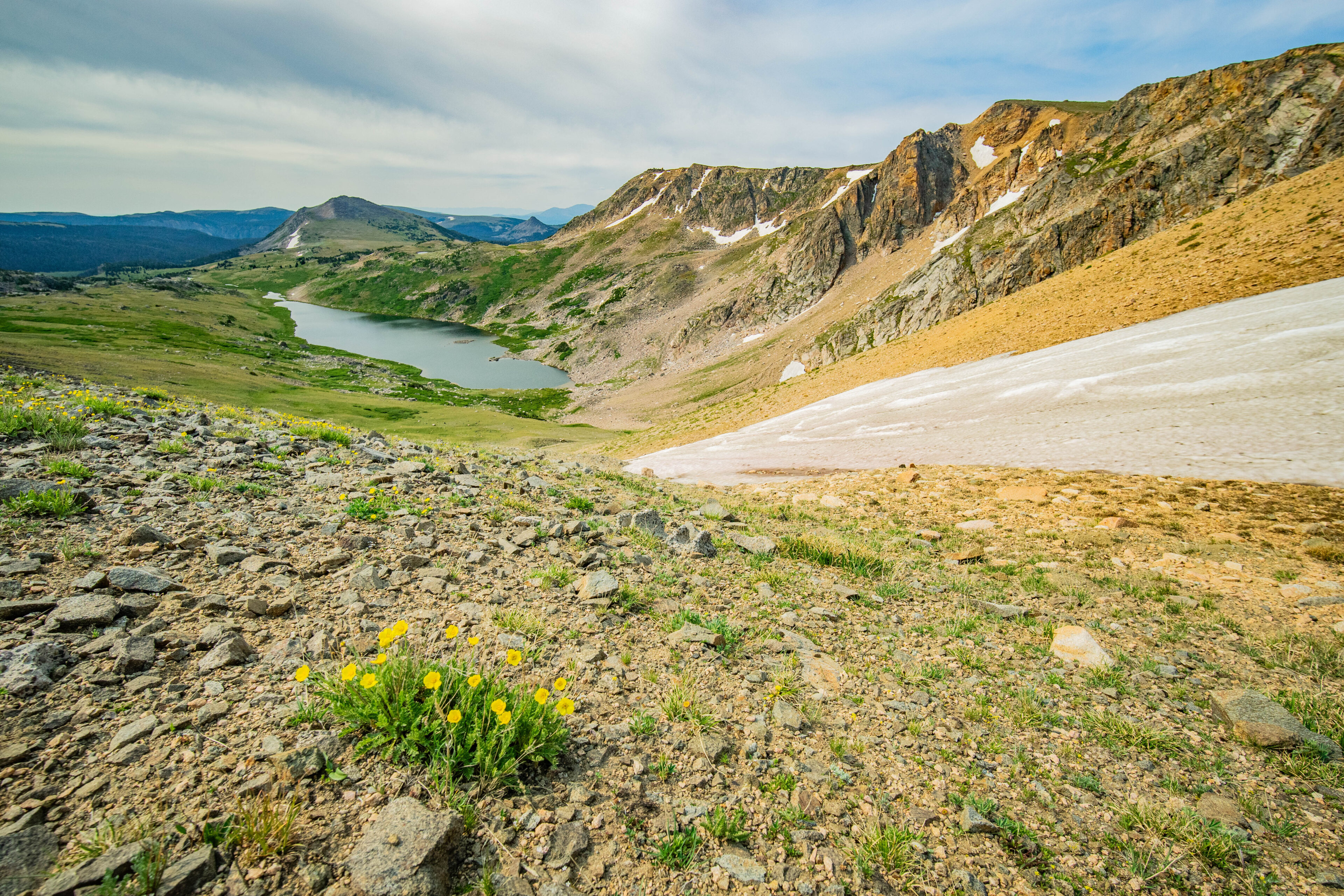
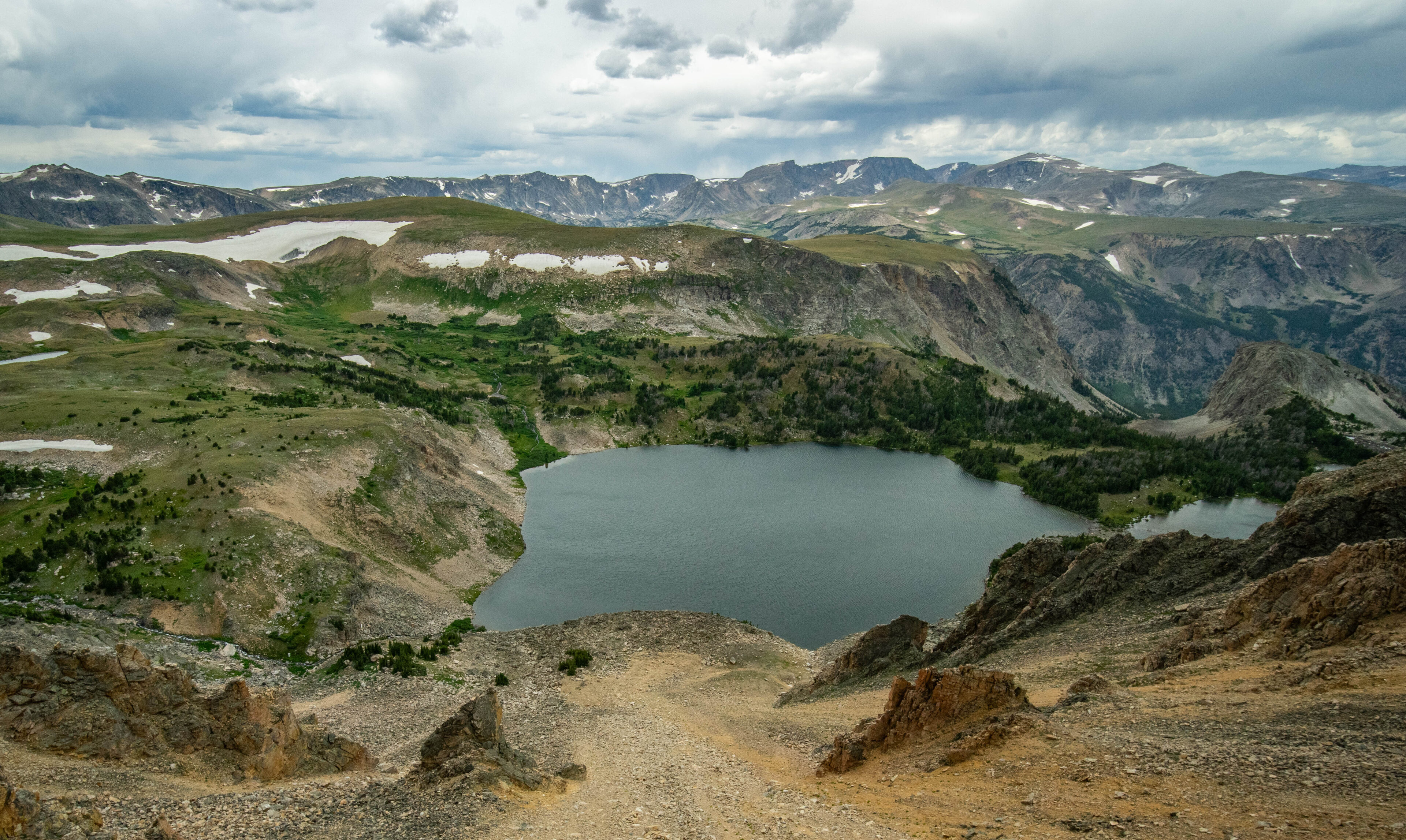
One thing you will notice as you drive the road is that once you reach the top, it is fairly flat. At least, compared to what you just drove. There are still plenty of steep sections, but it isn’t as wildly crazy as you might think. That said, one of the other commonplace things about a glacier-built landscape are the lakes. There are likely hundreds of lakes scattered around this region of the country, all left behind from the bowls carved by the glaciers. You’ll see plenty of these on your drive, including this large one. Some have names, some don’t, but they are all incredibly beautiful.
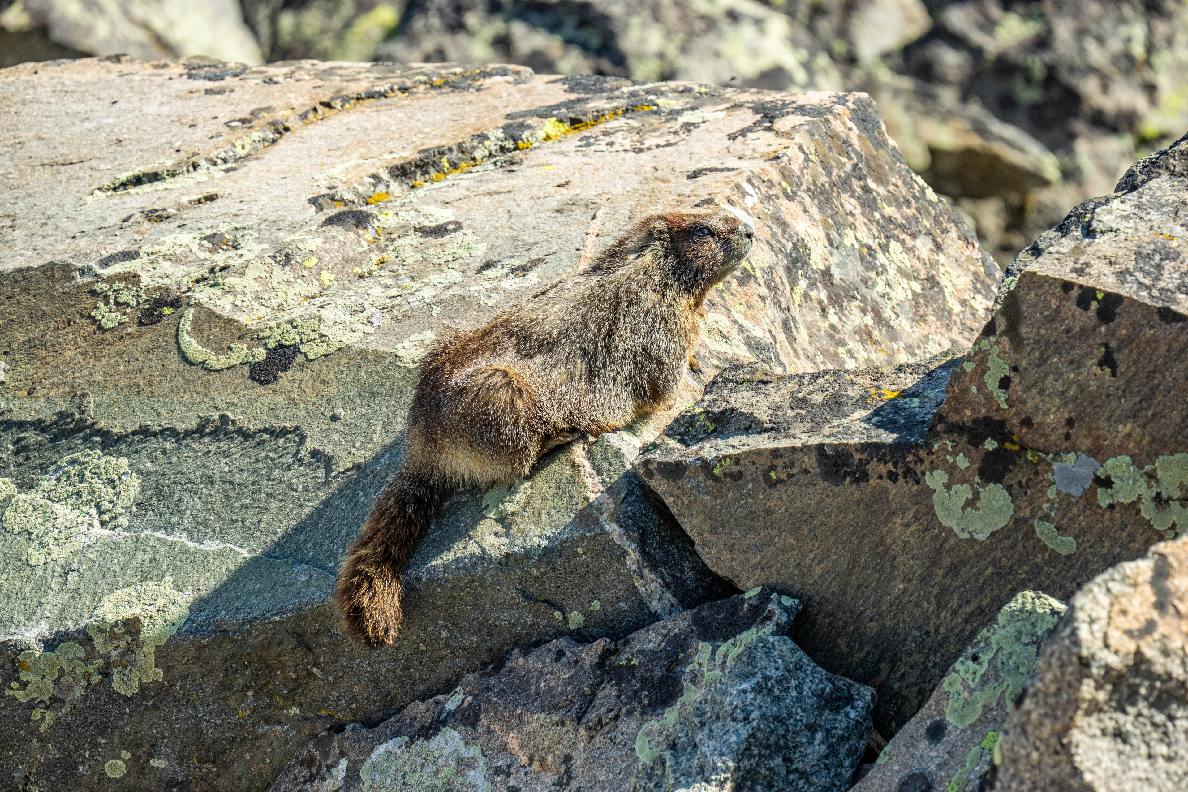
And, no trip to the high elevations is complete without taking at least one photo of the thousands of marmots that call this place home. If you are careful, you will also see some pika. We saw plenty of marmots and a handful of pika, but the pika are much harder to photograph. Luckily for me, while the pika weren’t cooperating the marmots were glad to pose.
We spent most of our day exploring this highway, as well as eating a delicious lunch in Red Lodge. We had one more night of rest before we began the hardest hike I’ve done in my life….
Check out Tyler’s other articles in this series